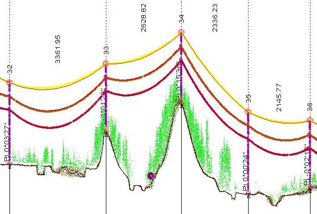
 Transmission Line Designing
 Electricity is transmitted at high voltages to reduce the energy lost in long distance transmission. Power is usually transmitted through overhead power lines. Since overhead transmission lines are uninsulated, design of these lines requires minimum clearances to be observed to maintain safety. Adverse weather conditions of high wind and low temperatures can lead to power outages: wind speeds as low as 43 km/h can permit conductors to encroach operating clearances, resulting in a flashover and loss of supply. We do designing of overhead translission lines profiling using latest software like PLS CADD, PLS TOWER, PLS POLE, Jove, etc. We do processing of LiDAR based point cloud data for the transmission line maintanance requirement like PLS Cadd Modeling, Profiling, Vegetation Cover, Thermal Rating, etc. We have succesfully completed many projects for the various transmission lines like 66Kv, 132Kv, 220Kv, 400Kv and 765Kv.

